New GPS system arrives to expand the teams capability. After much deliberation and testing we have added additional Geomax GPS/GNSS rover system with tilt function.
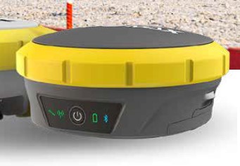

New GPS system arrives to expand the teams capability. After much deliberation and testing we have added additional Geomax GPS/GNSS rover system with tilt function.
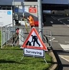
Recent works have included check surveys for large industrial sites and the add-in of new survey data to complete a project data set, for the next stage of its development.
Working to site restrictions, coping with the changeable weather have tested us and the equipment!
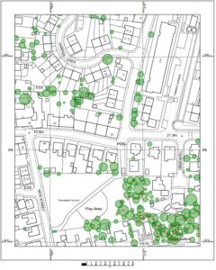
Tree data has just been added to the Masonmap OS portfolio. The option to buy tree height information at the same time as a planning application product is here now and is very cost effective!
A sample of the output with an OS planning map is below and starts from £5.00 plus VAT.
Our new print/copy/scan reprographics system has been installed in our Masonmap-Reprographics bureau.
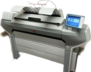
Using wax toner pearls, high speed printing and very long paper rolls we can achieve print runs like never before and output from CAD & Photo / posters with speed and quality!
We are now recruiting for an office based role creating unique mapping extracts and reprographics (scan, copy, print) – part time with growth opportunities – see our recruitment page!
We are looking to recruit survey assistants to train as land surveyors and experienced land Surveyors to lead and develop their team.
If you are over 18 looking for outdoors working with office based processing of your efforts to a high quality, then get in touch! Travel across the UK is to be expected and training will be provided!
If you are a seasoned land surveyor looking for a change, working on small to large scale projects, we would like to hear from you too!
After 8 months of focus, a major project is now complete.
Working with a key customer and satisfying their needs has been a priority for some time now. Data management, resource scheduling, field work and office processing have been key to achieving the project. The application of multiple laser scanner’s, Total station’s, operator’s and more CAD operative’s has been a pleasant challenge.
Getting ahead with field work, only to be up against it with the weather and data being processed timeously, as well as data storage and duplication of……….Well it is now complete.
A short break before we start again!
Share your project needs with us and let’s see what we can achieve together!
Back to Wembley, London to undertake tasks in support of ongoing developments.
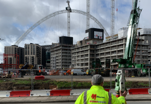
Supporting our client’s key partners, ensuring data integrity giving confidence to project teams, ahead of building works starting in earnest.
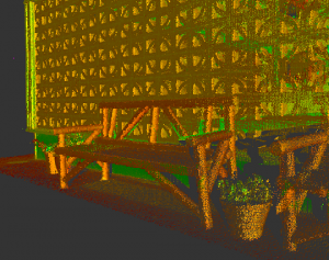
We were recently introduced to Leica’s newest laser scanners, revolutionizing the way we can map buildings both inside and out with the latest advancements in laser scanning technology, namely speed, image quality and on the go processing.
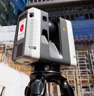
We’re proud to already offer this with our existing equipment that offers a powerful solution to capture precise data and deliver accuracy, however these state-of-the-art laser scanners are designed to seamlessly scan complex indoor and outdoor environments, providing you with detailed 3D data and accurate measurements of intricate architectural details to street-scapes.
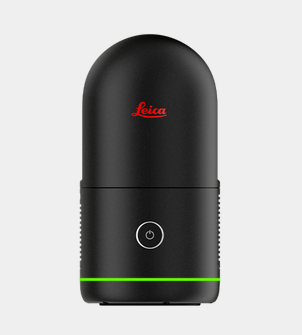
These scanners capture every nuance, enabling you to visualize and analyse spaces like never before.
Experience the speed and efficiency of laser scanners, with their advanced capabilities, we can quickly generate comprehensive elevations, floor plans, and point clouds that serve as a solid foundation for your projects.
Don’t miss out on the future of building mapping. Embrace the power of laser scanned data and unlock a new level of insight for your projects.
Contact us to learn more!
A client of ours who we have worked for to assist with developments abroad, dropped in to get plans produced and left us a gift of an old map. The map originally cost £0.25 pence and was bought for £4.00 locally, turns out to be from one of the oldest map publishers in the UK.