
Apologies, but no results were found for the requested archive. Perhaps searching will help find a related post.
- New Equipment arrives!New GPS system arrives to expand the teams capability. After much deliberation and testing we … Continue reading
- Check Surveys & New combined
 Recent works have included check surveys for large industrial sites and the add-in of new … Continue reading
 - New Masonmap Products
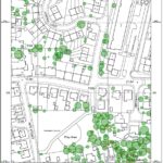 Tree data has just been added to the Masonmap OS portfolio. The option to buy … Continue reading
- New Equipment arrives!